Prusac
Prusac (Прусац) is a village in Bosnia and Herzegovina in the Central Bosnia Canton of the Federation of Bosnia and Herzegovina. It is one of the oldest villages in the Skopaljska valley located in the upstream area of the Vrbas river. It is located a few kilometres from Donji Vakuf.
Each year, Prusac is the site of the largest Muslim gathering in Europe. Every June thousands of Bosniaks and other Muslims gather at the holy site at Ajvatovica. It was known as "Akhisar" (White Castle in Turkish) during Ottoman rule.
The first historical record of Prusac under its present name, was about 1478 in a letter of Skender Pasha to Dubrovnik. In the Middle Ages, Prusac was part of the Uskoplje area, including the fortresses of Susid and Vesela Straža.
Map - Prusac
Map
Country - Bosnia_and_Herzegovina
 |
 |
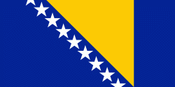
| Flag of Bosnia and Herzegovina | |
The area that is now Bosnia and Herzegovina has been inhabited by humans since at least the Upper Paleolithic, but evidence suggests that during the Neolithic age, permanent human settlements were established, including those that belonged to the Butmir, Kakanj, and Vučedol cultures. After the arrival of the first Indo-Europeans, the area was populated by several Illyrian and Celtic civilizations. Culturally, politically, and socially, the country has a rich and complex history. The ancestors of the South Slavic peoples that populate the area today arrived during the 6th through the 9th century. In the 12th century, the Banate of Bosnia was established; by the 14th century, this had evolved into the Kingdom of Bosnia. In the mid-15th century, it was annexed into the Ottoman Empire, under whose rule it remained until the late 19th century. The Ottomans brought Islam to the region, and altered much of the country's cultural and social outlook.
Currency / Language
| ISO | Currency | Symbol | Significant figures |
|---|---|---|---|
| BAM | Bosnia and Herzegovina convertible mark | KM or КМ | 2 |
| ISO | Language |
|---|---|
| BS | Bosnian language |
| HR | Croatian language |
| SR | Serbian language |


